Showing posts with label surfing. Show all posts

Sunday, July 29, 2018

A Day at Democrat Point

How ridiculous must I look? Surely I look ridiculous.

After about the fourth passing motorboat asked me and my companion if we needed help, I though perhaps the orange helmet I was wearing in perfectly safe waters belied the notion that we were OK.

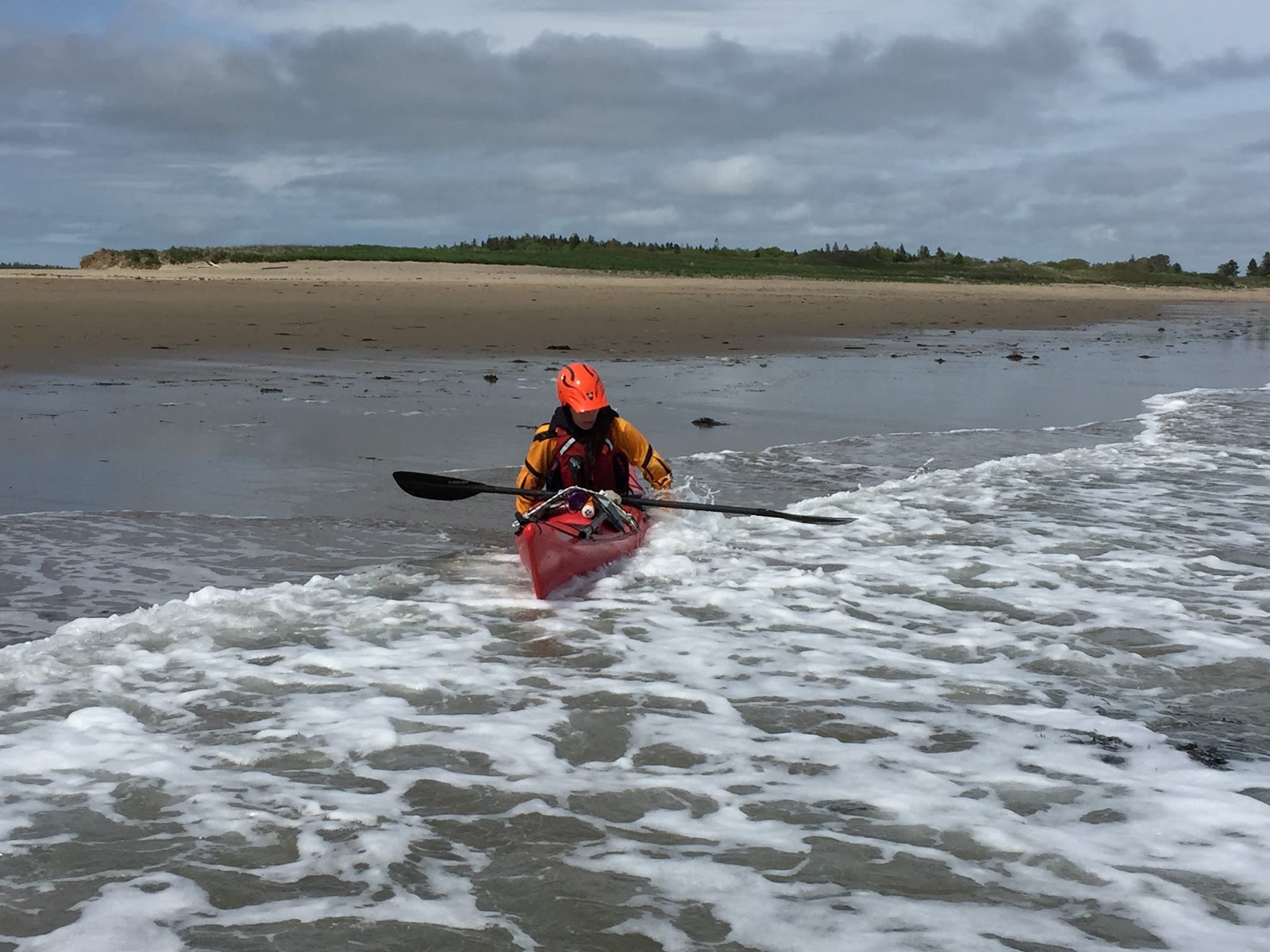
This was how we wound down our day at Democrat Point, Long Island.


We started off parking at one of the starred locations on the chart. At the start of the ebb, we had an easy time heading out. The "unsurveyed" area was very light on current, and had a big sandbar; we spotted a horseshoe crab swimming as we paddled out, and my companion spotted a spider crab as well. Near the channel, dozens of boats of various sizes, from little motorboats to multi-decked charter fishing boats, plied waters. The current's eddy line was noticeable, and after riding it to the narrowest point, we crossed and checked out the entrance to the inlet.


The water was bouncy, and in short order, a messy tiderace formed, ocean swell running into shallow water, against current. Over the course of the day, it would change shape as the ebb tide strengthened and the water level dropped. We only played for an hour or so, removing ourselves by the time the tide got close to two knots. Also, following a capsize and recovery, snack time was called.

While ashore we talked about how to control the boat on waves, especially in broach, and taking waves abeam. We also talked about how to take a range, or a transit, and after that, used that new bit of knowledge to cross the channel to the north, and found a lengthy beach to play along.

After that, we paddled eastward, eventually taking a break in a little nook that was shallow enough for standing but deep enough for rolling, and V (my aforementioned companion) got in some rolls. I did as well, practicing how to distinguish different parts of a roll. I even tried showing a roll without a boat, which is harder than it looks, but not as hard as it sounds.

We found a mini-tiderace nearby, with a small eddy, and that's where we decided to try some "rough water rescues". The water was moving, and the waves were big enough to require proper support, so the rescuer couldn't slack off on holding the boat. All that aside, this was near the approach the  motorboaters were taking to a mooring field, and it's at this point that people stopped and asked, repeatedly, for help. No one asked when we were about to be swept into the terrible maw of the open sea. But, with a friendly wave, we convinced everyone that we were fine. Trust me, I'm a professional.

Which brings me to the helmet. I'd carried it on my back deck, only wearing it for the surf session. Yet, when we were doing rescues, I wanted to keep it clear, and the easy solution was to put it on my head.

We finished the day paddling along the shore, avoiding the shallow area that had now become a wading place for birds and people clamming. We took a find shot at various rolls, hand rolls and offside rolls, before packing it all up and driving home.

Democrat Point is a bit of a drive from our usual area of operation, but it was well worth it. There are a variety of features to play with. It's not for beginners, but with a bit of planning, it offers a variety of learning activities.

Wednesday, May 31, 2017

Rockaway Point

Wow. It's been weeks since I posted last, though I know I've paddled since. I was so taken aback that I went through my calendar, weekend by weekend. It did this that weekend and that on this other weekend, and sure enough, except for a short trip out to enjoy my new boat (the Pace 18), I really haven't gotten out. I took a class in early May, and that was nice, but for weeks afterwards, weather kept me off.

Well, I made up for it this past weekend.

For Memorial Day weekend, I reserved camping at Bennet Field. This is my third time camping out here. In fact, I was here last year as well. Just like last year, the nearby Sebago Canoe Club held their season opener, including some interclub racing that I participated in (3rd, 2nd, and 3rd place BTW, in 100m, 400m, 800m sprints).

Also just like last year, on the Sunday after, DR and I set out for some surfing - only this time on schedule, and to great reward.

We set off from the old sea plan ramp, paddling south as military helicopters took off and set out for Manhattan. It was Fleet Week, after all.

Hangar B.

Helicopter taking off.

Helicopter flying away.

Our paddle out was mostly uneventful. We had more and more current as we went along, and while the day was partly cloudy, visibility was good. We avoided some pleasureboats, mostly setting out to go fishing, as we went under the Marine Parkway-Gil Hodges Bridge. We crossed south to the Rockaway side, then continued westward past varied beaches, mooring yards, and piers.

DR taking in the view.

Looking North.

Passing R10.

Our basic plan was to paddle out to the end of Rockaway Peninsula. We'd gotten some tips from the Commodore of the Sebago Canoe Club. West of the shipping channel was a very shallow area the broke incoming swell and, in some parts, formed a little island at low tide. We would come to call that place "Bird Island", because when we got out there, it was little more than a bald beach in the middle of the water, with various gulls on it.

To find it, we'd looked at a chart and seen it was just southwest from a range formed by the G7 and R6 buoys. So, we'd paddle out to those buoys, then cross the channel. The current would be ebbing, growing in strength at that, so to avoid getting taken out to see, we kept in from the channel.

However, as we paddled along we saw R10 (pictured above), then R8, and then . . .the end of the line. No more buoys, just the day marker mounted on the end of the jetty, the very southernmost tip of Rockaway Point.

Hmmm. Well, there were some big waves coming in, so yours truly paddled out to see what they were like. In hindsight this was probably unwise. The waves were tall and short-period, too short to surf properly. I ended up cruising in towards the rocks of the jetty, which was part of my plan: paddle the weaker current back up. The tidal current was ebbing, which meant that in the even of something going awry, I'd be carried out to sea, and more importantly, into the swell that wasn't already being broken by the jetty.

Also a larger sport-fishing boat came over and positioned itself at the end of the jetty. Fishermen love to get where fast current is whipping fish by like on a conveyor belt.

In any event, I completed my survey without misadventure, and came to the conclusion that we'd be better off finding our originally planned surf zone.

We landed for lunch on a pocket beach and orientated ourselves on the chart. We could see our quarry. It just wasn't near any of the buoys we'd planned for.

Here is a snip of the chart downloaded from NOAA May 31, 2017. The red X is approximately where I noodled in the big water, and the blue box is our approximate Area of Operation for the remainder of our surfing. Squint and you'll see that the last red buoy is R8, not R6, as indicated on my Maptech chart.

Rockaway Point

We landed at a beach not far north from the jetty, so our closest referents were the day marker on the jetty and G5. Based on landmarks to the north, we fixed out position and checked it once we launched, by paddling up to R8.

Location and theory confirmed, we set out to enjoy the surf.

Approaching "Bird Island".

As you can see, there is no island charted, but it does get quite shallow, and there is a spot that comes above the surface at low tide. It's bigger than the chart would have you believe, and forms a broad eddy, particularly on the western side. We found it very easy to surf in, ride the eddy up the western side, come around, and then paddle with current down the eastern side.

For that matter, in the surf zone, the current was weak enough that it was easy enough to turn around and paddle back into the surf, then ride it in.

For the birds.

Coney Island in the distance.

We surfed, and surfed, and surfed and surfed. Farther out there were bigger waves, closer in, smaller waves. We had set out near the end of the peak ebb, so the waters calmed as the afternoon wore on.

One phenomenon that we both experienced, no matter what we did to edge or trim, was that we'd get continually cocked to the right while riding a way. In some spots, there were clearly two wave systems intersecting, and one would take you off the other. At one point, it seemed like I was getting weathercocked, as the wind picked up. We tried trimming forward, backwards, edging left and right. Mostly we were just able to manage coming off the wave early and circling back to try again.

As the water got more shallow, I began to feel its effects. Even on the smaller waves, I found my boat starting to plow into the sand. We started experiencing breaking waves - not huge pounders, they were still 1-2 feet, but breaking nonetheless. It was one of these that finally put me off balance into a capsize - in about two feet of water.

I tried my roll, a couple of times at least. I even stopped to try figuring out if I was coming up on the correct side of the wave - pretty sure I was. But, by the third attempt. I realized I was reaching over the top and not getting the support I needed, and my shoulder was dragging on the sand, so I exited, and there I was, standing on a sand bank in the surf off Rockaway Point.

A couple of thoughts went through my head, while I held on to my boat, keeping it downstream of me. First was, I know in whitewater we're not supposed to stand up - but while the waves were relentless, they weren't worse than any shore surf I've stood in. Second was, should I self-rescue? But in my estimated I thought it was a good opportunity to try an assisted rescue in bouncy water.

DR didn't think so. He was worried about bumping into me - and in hindsight, that wasn't an unrealistic concern. He also comes from a whitewater background, where the better play is usually to let the casualty wash out down stream - although in these conditions, neither of us was sure if "downstream" meant the bird island or the lower harbor.

Instead, what I did was swim my boat out of the surf zone, and form there we did a conventional assisted rescue.

Problem solved, we surfed another forty minutes or so, basically running out the clock until the tide was a bit further past slack. We'd ride the flood in to Jamaica Bay - the opposite of our ride out.

Taking a break on bird island.

Cruise ships and more, in the distant Ambrose Channel.

Far in the distance, we could see ships coming in and heading out along the Ambrose Channel. We could even make out West Bank light and Romer light, two of the lighthouses that mark the treacherous shoals of the lower harbor.

Our route back was more than a bit of work. The predicted F3-F4 winds were on the higher end of that scale, primarily headwinds as we paddled towards the bridge and under, and then as crosswinds while we paddled north. Fortunately the tidal currents improved in our favor, so as we might have been paddling slower, the currents made up for it.

The wind also chilled us a bit. We'd felt a bit overdressed in various layers of neoprene earlier in the morning, but were glad to have multiple layers now, as well as paddling jackets. Once we landed, DR got to break in my fancy Kokatat storm cag; he reports it was very warm and kept him comfortable while we packed up kit and boats. I was wearing my Reed Chillcheater dry cag, and once onshore had some rain paints on to keep the wind off.

Overall it was quite a fun day. I've been meaning to check out this surf spot for a while, and I learned a lot very quickly. I think in the future I'd time it differently, and it's certainly not an environment for beginners, or even improvers who do not have surf experienced. Like most of NYC, there is a bit of traffic to manage. It's also a bit of a schlep to get to. All that being said, it is a fun place to play, and I hope to go back.

Saturday, November 12, 2016

Sandy Hook Launch

MM is a friend of mine who lives in Monmouth County, basically the stretch of land from the I-95 corridor over to Sandy Hook. She's outdoorsy and athletic, into things like winter camping and biking and climbing and hiking. She's also a surfer, in the board sense, so while we met in a kayaking instructional class, she's always talked up how we should try some surf sometime.

So, last Monday, I drove all the way down to Sandy Hook and met her in one of the parking lots on the ocean side, to survey the scene. Sandy Hook is a long spit pointing almost straight up towards the NYC harbor; it receives a lot of swell on the ocean side, and has a protected bay side, albeit with a lot of fetch. It's a short walk from one side of the hook to the other, so paddlers have their choice: ocean side or bay side.

I've launched from the bay side before. I've heard of people launching on the ocean side, but it's challenging. First of all, along most of the short, the water level rises quite sharply; you can even see this standing on the bank, where a gentle slope of dry sand abruptly dives into the water. The waves are therefore a bit dumpy, and hard to get into the water at all, let alone paddle against.

On this particular day, the other challenge was a steady F4 wind lingering from the previous day, pushing with swell, to create some short period waves (5.2, 5.4 seconds) with wave height of three to four feet. Put this together with the dumpy characteristics, and what we saw was constant rollers cascading just past the shoreline, washing up, and then falling out to be recirculated by the next wave.

MM knew a spot near a jetty though. Also, the shore extended out a bit, so the break was farther away, and while we were still watching foamy hills come up to the shore, it wasn't quite as intimidating.

Here, take a look for yourself.


We decided that the surf zone was, at best, going to be more work that it was worth: it was short, and there wasn't a lot of runway to come off a wave before landing, and coming out again would be a lot work, even assuming no out-of-boat experiences. So, we decided to "circumnavigate" the Hook to the bayside, what MM and her local buddies call a "reverse hooker".

As we proceeded north-ish, we took steady wind abeam, along with swells. You can get a good idea of wave height at about the 2:10 mark in the video above. Generally 3-4 feet, with occasional 5. There were moments when we couldn't see each other, so we kept close.

As we came around the hook, we paddled over a large bank known as the False Hook. As the tide was flooding in, there wasn't as much action there as we hoped, but we had some current and small swell as we paddled past the channel marker.

The entire day was sunny and brilliant, and we could see for miles: ships coming in from sea; the skylines of Manhattan and Jersey City; Romer Light, just two miles away, even the bridge connecting the Rockaways to the rest of Queens.

The bayside had much flatter water, though by no means still. We paddle along the now-familiar shore, past Horseshoe Cove, landing at a small beach that was literally across the street from where we parked. We washed up and had lunch, and that was our day.

Sandy Hook is an interesting place to paddle. It's far to get to, and once there, specific features can be a ways off from paddling. All the same, it's proving to be a good place to go to work in conditions that are hard to find in NYC.


Tuesday, September 6, 2016

A Taste of Sea

I'd wanted to paddle and camp this past Labor Day weekend, Sept 3-5 for those of you non-US readers. In fact I wanted to paddle and camp all the major surf holidays, and get groups together to pad out my leadership log, but I missed the last one and then spent most of July and August teaching. So, I arrived at the end of summer not sure what I'd do this weekend.

Fortunately, in addition to Mr Cowgirl, I was able to cajole three members of my local paddling club into coming up to Westport, Massachutesess to do some coastal kayaking. There's a local paddling shop there on the Westport River, great camping at Westport Camping Grounds, and easy access to a variety of coastal features. 

While I will assert that New York City offers a variety of sea kayaking opportunities, certain things are hard to find good examples of, namely surf, and committed shorelines exposed to open sea. For those of you following along at home, take a look at NOAA chart 13228 and you'll see what I mean.

There's some nice tidal eddies about a mile up the river mouth, below the Route 88 bridge. There's exposed coast at Horseneck Beach, with a too-convenient spit of land called Gooseberry Neck that has 1) free parking and 2) a proper ramp and therefore the expectation that mariners will land there. There's Sakonnet point, which we didn't get to, and then farther east there's the beginning of Buzzards Bay. 

On top of that, another club member has family in the area, and in exchange for giving her a ride up (and back) we got to overnight in a proper coastal cottage and put in on a privately owned beach. Bliss, buckaroos. Pure kayaking bliss.

I packed up the buggy and we set out on the road.

Stopping for Dinner on the Highway.

Sunrise Hospitality.

Saturday
Following the drive up Friday, we cleaned up, met the folks, and laid out our sleeping bags on the air mattress and sofabed provided by our hosts. Only half our group, myself and G, were present, but with out fellow club member and her s.o., we put together a tidy group and set out for an area called "Dumpling Rocks", near Round Hill Point, and then to an area of rocks, and then on to a Christmas Buoy - red and green, marking the intersection of two channels.


Launching from the Beach. G, A, and L.

Paddling Out.

It's Christmas in Heaven!

On the way out, we took the opportunity to try some very light rock-hopping near Dumpling Rock. We were light on helmets, and the environment was new to some, so we played it safe - going around the big rock and taking a deeper channel. There was a more narrow constriction that had some interesting current flow, but most of the group was not ready for that.

One word: Millenials.

The ride back was fairly pleasant. Our big concern for the weekend was tropical storm Hermine (later, "post-tropical" storm Hermine). Traveling up the eastern US seaboard from the Caribbean, Hermine promised storm surge and high winds and rain, but ultimately steered ENE and petered out several hundred miles offshore. We got high winds over the weekend, and nothing more.

At the time however, that was not a certainty. In the afternoon, we met up our other friends at the campsite and checked in, and after setting up camp drove out to Gooseberry Neck, a small spit jutting directly out from Horseneck Beach. There's free parking, easy access to the water, and just like that you're at sea. No rivers, no coves, just the ocean.

As we launched, a larger group of paddlers came in. They were part of a Rhode Island club and had gone out to Elevator Rock, a spot where surf can place a skilled paddler on a rock, and then take them right back down. I've only heard of it recently, and with the impending weather had already ruled it out.

Instead, we paddled out from the east side of the spit and then south, taking a trip around it. We expected the easterly winds to become stronger and produce more challenging water, and the water we had was challenge enough for this group. For some this was their first time in the ocean proper, and just getting acclimated was enough. We practiced some brace strokes and how to manage paddling in the wind, then set off on our journey.

Around the southern tip we spotted some clever rocks to play near. We also discussed some navigation, using nearby buoys to triangulate our location against the southern tip of the spit. In the rocks, we found a long shallow shelf that created some dramatic looking waves, but they were just a long, wide area that lost energy quickly. We practiced paddling in place to hold position.

Coming back along the western side of the spit, the water was calm and the air was more quiet. With the sun setting to our, it was a relaxing end to the day. I landed first, followed by the other two women in our group. The men lingered. Why?

Kayak Cowgirl's trusty steed.

Turns out they were being followed by seals. Seals! Three of them. As they approached only one seal followed them in, and we could spot him from our landing spot.

Men, chased by seals.

Driving out, we passed over the road with sea to our left an to our right. The water to the east was clearly darker and more agitated, while the water to the west was calm and relaxing.

Sunday
Sunday was predicted to be very windy, initially 20mph but proving just to the mid-teens. We decided to stay sheltered from the sea, up the Westport river about a mile from its mouth. It turns out there is cheap ($5 per car) parking there, with a giant rock in the middle of a narrow river offering a fun place to stay  .  .  .and play

Getting ready to roll out.

Off we went, playing around the rock and then heading downstream to the mouth of the river. The wind proved constant, blowing us downstream, and reminding us we'd have a bit of a battle on the way back.

We passed through an extensive marina before the river widened and we came to Horseneck Point. From there we could make out a giant boulder called "The Knubble" marking the far entrance to the river - and beautiful surf rolling in. The group was taken in. "Surf!". Only, almost no one had done it before, so we landed briefly to go over surfing, and landing in surf, and setting the boundaries.

Everyone had a good time. I caught the fewest waves, but mostly because I was keeping an eye on everyone. The wind was coming abeam and so we kept getting pushed across the river. After a few runs, and with the surf depleted as the tide lowered, we set out back the way we came - and this was the start of the hardest part of the day.

The current had only started to ebb an hour earlier, but was already quite strong. Couple with the wind, we had a long slog back. In hindsight, and to some of us at the time, we actually made expected progress: a little over one nautical mile in thirty-five minutes, fighting about a knot or knot and change of current, with a F4 headwind. Good on my group for making the distance. Once we'd returned, we took a long lunch and rested, before going out for a couple more hours.

We didn't go anywhere for that last bit. Instead, we played in the rock eddy some more, this time with more eddies to work with, as the lowered tide had revealed more rocks to ferry between. We also tried a rescue in the eddy area, and I demonstrated some swimmer recovery methods.

At the end, we packed up and dried off, then walked in to the local establishment for sizable meals and beer followed by dessert.

Monday
While I'd hoped to paddle a bit Monday, by then even the sheltered area of the campsite was demonstrating stiff breezes, and the coastal wind prediction was to be 20 mph and more. The group had gotten a taste of the sea, and were plenty well buffed and chuffed from the day before, and one of the drivers had to leave to make it to work in NYC that afternoon, so - we called it a weekend. 

Packed and sorted, I dropped off one boat we had borrowed from our local friends, visited the local paddling shop (Osprey Sea Kayak Adventures, check them out sometime), and then we were off for the four-hour drive back home.

This was a great trip and I hope to do it again sometime, with some more people and certainly more time at sea. With summer nominally over, it's on to the next part of the season. More to come, for sure.

Tuesday, June 28, 2016

A House of Surf and Fog

Over Memorial Day Weekend - nearly a month ago - I managed to do some camping out at Floyd Bennet Field. You may recall I camped out here with some friends last fall, and was back with most of them again. The difference was, we base-camped instead of kayak camping. We drove our cars and boats out, but only kept the one camp, rather than packing it all in for Staten Island.

Partly this was practical. I was organizing an event at the nearby Sebago Canoe Club that Saturday, so packing up to go and come back was going to eat up time I'd spend enjoying the area. The area, of course was Jamaica Bay. I'll write about the event itself later; here's what we did on our big paddle day.

We all wanted to try some surf, and there's brilliant surf at Rockaway and Breezy Points, where the open ocean first touches New York City. To get there we'd have to paddle about three or four miles, and as it happened we were a bit lazy in the morning, and so paddled against some tide on the way out.
Preparing to depart.

Passing along the old airfield.

Striking a pose.

After paddling out past the bay bridge that connects the Rockaways to Brooklyn, we made a brief stop for lunch on a beach before heading out to Rockaway Point. Breezy was a bit further, and we were already seeing nice wind waves pushed by an easterly breeze.

Testing the waters.

Trying to get a speedy start.

It took us a while to sort the waves. Primarily wind-blown, tide on current, they struck the beach at a very shallow angle. The result was, we had to paddle out pretty far just to catch them, and rather than surf evenly in to the beach, we'd just find ourselves on an elongated taper, coming off with a low brace and repositioning to head back out.

Waiting.

Keeping position.

Bad form!

Most of the waves were like this

After a while, we were tired, and the waves were getting less pronounced as the tide rose.  We took a few more runs and decided to head in.


Here is where the trip got interesting. We could make out a thick hazing drifting in from the west, and closer and faster, we could make out a low fog drifting northwards from the sea over the Rockaways. it looked more like smoke from two forest fires, but was fog, possibly an inversion layer.


In a matter of minutes we could tell that the entire outlet was about to be enshrouded in fog - and we had about a mile to cross at the bay and a mile to the bridge, before heading in to Jamaica Bay proper. We'd seen a large barge and some party vessels about. We decided to cross the bay earlier than planned, at about its widest point.

This turned out to be a wise course of action. As we crossed, we had to wait and radio our intentions to two party boats out of Sheepshead Bay, and by the time we were all the way across, the fog had dropped visibility to under a mile. We couldn't see the bridge, nor the far shore, but both were maybe a twenty minute paddle away.

We crossed one last marina mouth at its narrowest point, having seen a number of pleasure boats scurry in (and out, oddly). We were soon under the bridge, and handrailing close to the shore, until we could make out the old hangar and radomes.


It was an odd paddle, an eerie one in a way. The fog happened so fast, and was so thick. I've been in fog before but it's usually much more gradual, and a phenomenon of cool weather. We'd been in the low 80s F, wearing jackets only because of the breeze. It was muggy as we paddled back, and what photos I've got here of the fog are from when it was lightening. It was thick as soup before!


A good one for the Cowgirl's final send-off, should it occur.

The fog was a harbinger of bad weather to come; we ultimately called out weekend short and went out for dinner at a lobster shack on the way home. Jamaica Bay is lovely, and I hope to paddle there again, under more fair weather conditions.

Sunday, June 5, 2016

Maine Again

There I was, watching the surf road in towards me as I peeked out from behind a little rock. I to the first wave well, but the second one caught my starboard bow and I was pushed into the cliff and capsized on a shelf, unable to roll up . . .

Or, There I was, bobbing up and down in the surf trying to catch some admittedly not-great waves, getting some speed, getting a little cocked by the wind, and suddenly I'm sideways to two feet of water column crashing over my boat, bracing, then getting cocked again and dropping a stern rudder to keep it straight. . .

Or maybe, I taught the class of new-to-sea kayakers how to launch into surf - pointing perpendicular, getting some speed, not getting between their boat and the shore if the came out prematurely. Then I launched them, one by one, all successfully, including the fellow who was nervous because his spraydeck did not fit well and all his previous surf experience was, in his words, "disastrous." The lead instructor later told me I managed a Four Star level launch.

They say, lead with your strengths, but those are never the good stories.

I was in Maine again, in the Georgetown / Five Islands area, for less time that I'd planned for. I was going to be up there Wednesday through Friday but day job responsibilities meant that I only got two of those days, rushing home Wednesday evening to hop in the car, completely pre-packed, and make the drive to Maine by midnight (some detouring made it more like 1 AM). Five hours of sleep later, I was meeting the crew, mostly paddlers from the New Jersey and Hudson Valley area, whose experience was primarily lakes and the calmer portions of the Hudson River.

John Carmody and Matt Kane were teaching the course. What the other students described sounded similar to my first time up there: some work in eddies north of camp, and then some surf, and then some rock-hopping. They were all very excited about the eddy work. The area around Knubble Bay is rife with narrow tributaries all keeping into Sheepscot Bay and thence to sea, with some tideraces as well as strong eddy lines.

My role was as a sort of flywheel; I learned and reinforced some of what I'd learned in previous trips to the area, but also got the chance to instruct and lead in an environment with features that are not easily found in New York City.

Surf
For the surf session we drove out to Reid Park and observed the shore from an elevated area, talking about different water features. As we prepared to unload boats and kit out, one of the instructors approached me and asked, "you're OK with coaching a surf launch here, right?"

Well what am I gonna say? Yes! And then I'm thinking, I better get down to look more closely at that beach. 

Not to worry, it was perfectly fine. The wave period that day was about 8 seconds farther out, and the beach was such that it had a gradual slope resulting in 1-2 foot waves that petered out over about 10 yards at the break. So I coached them. The only two things I would have done differently were to launch one at a time (I'd tried two, and it was just hard to keep track of) and also, setting them further into the surf. I ended up having to drag four or five boats a full boat-length to get them floating. But the students were great.

Maintaining Position. Photo courtesy Chris Brown.

Then, I got to be a student. We went to a spot where an inlet was draining in to the ocean, and there was a gentle yet scary-looking bit of surf that students could paddle through to get to sheltered water, and an even scarier-looking tiderace that I was encouraged to surf through. John caught a great wave and surfed it through, letting it cock the back of his boat to come right around into the sheltered water. Matt went in and out of the rough stuff several times to shepherd each of his charges.

I sidled up to the rough stuff, paddling backwards to keep position, just looking. Where was the line? Where was the big rock to watch out for? I spotted both and then BAM! a big wave caught me and suddenly I was ruddering my way in, and God help me my little 15' Gemini started to pearl - the entire front deck was underwater! I leaned back and the wave passed under me and I quickly got in to the sheltered spot.

Ridin' the wave once more.  Photo courtesy Chris Brown.

There was plenty more. We practiced controlled landings, paddling backwards into incoming surf, paddling forwards into incoming surf in order the land backwards, carving turns to come off waves, back-paddling in order to give up a wave. I got a little more coaching in too, advising one participant to no lean back when he was trying to power forward and over a wave. He noticed the difference and brought that up as a learning point with our group review.

End of a Bongo Slide. Photo courtesy Chris Brown.


I really like surf. I mean to do more locally this summer.


Rock

Can't stop . . .can't stop. . .can't stop, stop, the rock . . .or the waves.

On our final day we drove out to Five Islands and put in near the mooring yard there. Within less than half a mile we had two sizable rock islands to paddle around, with features changing as the tide ran out.

We took the group out and practiced running along the shore, T and I ahead of the group. John encouraged me to back into a little nook not much wider than my kayak. It was sheltered from the incoming current, and somehow there was water that would flow around and back out. I was able to back in, and then get pushed out, eventually surfing my way back out.

A little further up, T and I paddled through and back a narrow race where the water deflected around a rock, and then were given the task to guide the newer students through it. We did, and everyone came through OK, slicing up over some sizable waves and away from the cliff face.

Working out the route with T.

Next, we found a large horseshoe route around a large rock. Here, the incoming ocean swells would hit one end of the passage and then break over the rock. What this meant was, it was harder to enter the first end, but easier on the second, because the energy of the wave was dissipated. The trick was to enter the far end, line up perpendicular to the incoming waves, and paddle out.

I managed this on my first try, and then the group went through one at a time. John pointed out there was a chill spot of water behind the rock. The water level moved up and down but otherwise there was not lateral movement.

On my second go, I made a critical mistake. I got in to the relaxed water and then watched the horizon for a smaller wave set. I saw things flatten out and started to nose out, going a little wider to my left to avoid a rock I knew would be to my right. This put me in a bad position though, as a wave came in and caught me while I was trying to turn into it. The wave caught me boat and pushed me into out little inlet.

No problem, I thought, I handled that well, and started to turn to again. But now, here came a second, larger wave, at a pretty good speed. She caught the front quarter of my boat and as I braced into the wave, I was pushed against the rock face to my left, and capsized. I felt my helmet hit rock. I tried to roll up, but I was on a sloped ledge, no longer with water supporting me. It was time to give up.

Matt raced in and we quickly did a swimmer contact tow to get me and my boat out. I held on the his boat and mine, paddled under my arm, and he pulled me out of the zone, and then we did a rescue.

I'm sure it looked dramatic, but throughout the whole ordeal I felt fine. At the point of capsize I was a little worried about popping my sprayskirt while getting pounded by surf, but before and after I felt like it was fun. I pushed myself. I made a mistake, and I learned from it. I did everything I've been trained for to be rescued in a dynamic environment. I was properly protected both for water temperature and head trauma. This is the sport. This is the sea.

Anyhoo, we continue on a bit. As a group we practiced getting our noses and tales up close to the rock, finding chill spots of water, paddling backwards to keep position. We had a fair amount of eddy current moving us clockwise around the island, and I had to reset a couple of times to find the good stuff. Here's what it looked like, more or less, with my PowerShot carefully balanced on deck.

Kiss the Rock.

After that, we moseyed on home, back to where we put in, at a considerably lower water level. We climbed out and dragged our boats, even the glass ones, over seaweed.

And with that we were done. We unkitted, packed the boats, and a few changed clothes. We made our farewells after final debriefing with the coaches, and then excellent lobster rolls at the local country store (and not for nothing, I found cans of Moxie soda! So rare and divine, and aptly named for my activities there).

I love Maine, and expect to go there again. I will need new shores to develop skills against, but these now-familiar waters provide plenty of development opportunities. Plus it's just beautiful.

Many thanks to Matt Kane of Prime Paddlesports for inviting me, and John Carmody for some long-term coaching and development in these waters.

Thursday, November 19, 2015

Fishers Island Sound 2015

I know I'll go again. I wish I could have spent more time.

Fishers Island is a long, narrow island about two miles off the Connecticut coast, northeast from the north fork of Long Island and part of NewYork State, even though it's technically farther away from it.

There's a lot of lore about Fishers Island, but we weren't there for the island. We were there for the sound!

At the eastern edge of Fishers Island sound, the underwater hydrography is such that water coming in (westward) with the tide ramps up rather quickly, about forty to sixty feet in less than an eighth of a mile. Additionally on the days we were there, there was a steady Western wind blowing, making for great wind-against-current conditions.

D, K, and CC taking a wee break.

Several folks had gone out on Friday. I had to work, and so drove up Friday night for the Saturday play. This turned out to be the most challenging day we faced.

The challenge was the wind. Not only was in in the Force 6 vicinity (25-30 mph with gusts to 35), it changed direction. As we tried to surf down wind, our boats would get cocked and the direction of the waves would change. I felt comfortable in the conditions - big, lumpy water, waves three or four feet high, sometimes taller - but trying to surf was pretty tough. We took a break on Ram Island for lunch and to figure out what to do next.

The Break on Ram Island.


We decided to split into two groups. There were over a dozen people all in, so each group had more than enough for safety's sake. One group would continue surfing downwind and work out a shuttle to get back to cars. The rest of us would paddle into Mystic harbor, then up the river. We were expecting to meet a couple of friends of mine who were driving up Saturday and putting their boats in far up the river.

Among our Fleet, a Rockpool Taran.


We expected the latter trip would be the easy one, since no one was paddling against the wind. However, the wind shifted to come from the north (making this a veering wind rather than a backing wind, weather nerds), and so we slogged against a northerly headwind for about three quarters of a mile.

The Slog.


Over the radio we heard the other group announce they were quitting their plan and would sort an alternative. Our leader directed us to head up the river, and he'd go back for a car to shuttle us back.

An HV paddler struggles against the wind.


That's the kind of weekend this was. We were in a dynamic environment and had to work out alternatives to our various plans.

We rounded a corner and started to find shelter from the wind. Our contingent had spread out with varying strategies for the wind. One paddler in particular struggled, in a new boat and a bit fidgety with kit. Once in the harbor though, the wind was no longer ridiculous but merely a nuisance, now coming at the quarter but greatly reduced by the town's structures. We paddled up and met our friends, who were happy to return and avoid the adventures we'd had coming in. The rest of our journey was a scenic trip through the harbor town of Mystic, Connecticut.

Paddling up the Mystic.

An unusually named boat.

Paddling under a coutner-weight bridge.

On past lovely homes.

When we arrived at our destination, our trip leader presented us with hot chocolate and in short order we loaded our boats onto vehicles. We drove back to the parking lot where we'd put in, and then back to the house we were staying at.

The house is worth mentioning. It's a large house, owned by a family and rented out to groups like us, or graduation parties, or weddings. I arrived very late the night before, after everyone had gone to bed, and the street address proved to be around the corner from parking. The afternoon was my first chance to really assay the place.

We all pitched together for dinner, pooling money for some fine salmon and steak cuts, and salad, and baked potatoes. I chopped garlic for garlic bread. Despite our shortened day, we were all hungry - these calories were all burned easily, replacing the old and ready to fuel the next day.

Sunday was more enjoyable. Winds were still in the Force 4 range, gusting to Force 5, but the direction remained consistent. We started in Stonington - a historic town with a speed limit of twenty miles per hour - and this time paddled out farther lunching on the northeastern tip of Fishers Island itself.

But first, we were in the chop. This was tremendous. It took some doing, but I did manage to catch some waves and ride them for a bit. I practiced starting my sprint before being fully in the trough - some advice I got was that with a shorter boat I needed to start sooner.

I did take a dive though - while looking where I wanted to go, according to one observer I was on top of a wave, went for support, and found none, so I capsized. I managed to roll up though, and felt rather chuffed about that.

Latimer Light - Halfway There!

A brief respite in a windbreak.

We had rougher, bigger water between the lighthouse and Fishers Island. It was still great fun, but the waves had a shorter period and after a while I felt like I was just managing big following seas - the waves riding up under me and passing me before I could gain much momentum.

Then I saw it: a flash of white, and cries of "boat over!", just about twenty yards ahead of me.

The waves lifted the boat in and out of sight. Another paddler got to the boat but the casualty was separated from it, floating further back. In hindsight, the current was carrying him towards me but the wind was blowing his boat away from us. I got in and provided support while his boat was emptied.

I tried to get closer to that vessel but we eventually decided it was easier to bring the boat to me. I then supported the rescuer while he supported the casualty's boat, all while bobbing in three to five foot seas. In short order we were on our way.

We continued surfing, working our way south, and then we landed for lunch.

Lunch on Fishers Island.

I have to mention this Rockpool Taran. These are well-regarded boats, but very rare in the US. It's like finding a right-hand drive Triumph.

I learned here that a friend of mine I'd invited was not having such a great day. She was game, but the conditions were strong enough that she'd capsized a couple of times and spent most of the session on shore.

On the way back, we ferried against the wind, no longer with the current against it. If we hadn't ferried we'd easily have been blown out of the sound. We got to the lighthouse, took a break, and then continued on.

There were two more capsizes with subsequent rescues. With one of them, we decided to tow the paddler, and yours truly served as support while two others formed an I-tow. I clamped in my contact two as without it, the larger waves pushed our boats apart, and meantime we were bobbing up and down in these immense seas. We did this about three-quarters of a mile, until near shore, and we landed and everyone got out.

Lunch.

All but one that is. There was one unaccounted for, until we spotted him near the far end of the inner side of the breakwater. We still don't know if that was on purpose or not, but he paddled in, and we were all glad to have everyone in.

These were an exciting two days at sea. They were certainly a challenge, but this was a great bunch of people, and qualified for the conditions as well. I certainly got my first taste of big water, lumpy water, and I want more. I am reminded though of an adage one of my coaches is fond of:

"The sea will often give the test before the lesson."