Showing posts with label lighthouse. Show all posts

Monday, December 5, 2016

O Captain ! Great Captain !

I paddled right after Thanksgiving with the westchester crowd - my good friends the 2 Geeks, and AD, JT, JB, and B with the Nordkapp. We're paddled pretty regularly, some more than others, as AD and Jean look to build their leadership logs, and the others just want to practice basic skills. We went around Hart Island, and later went out to Jones Beach, and most recently, met up in AD's back yard (literally) to paddle from Mamaroneck to the Captain Islands - right around the corner in Greenwich, CT.

AD lives in a swell-looking condo right on the waterfront, complete with a kayak rack in the back yard and a proper gym and sports club on the grown floor. We were able to park in a pleasant residential neighborhood, putting in at a beach at a the end of a dead end street. The 2 Geeks paddled over from their boathouse in Larchmont, and once we were all assembled, we set out.

Unlike our previous journies, this one had a pretty stiff onshore wind, and the tide was unusually high as well. The tide meant we were able to take a shortcut out over a low point in Hen Island, but the wind would be hitting us abeam as we came about along the coast.

Leaving Mamaroneck.

A pleasant little gap.

Assembled for the briefing.

AD ready to lead.

After a short on-water briefing in the lee of a rock, we set out, and went around Milton Point to cross the long harbor from which we could see Rye Playland - and old amuement park, still operating in the warmer months. To lessen the wind we paddled closer in, and after assessing the overall speed of the group, made a short stop for a bio-break.

Rounding Milton Point.

From here, it was determined that about half the group would want to turn back earlier than the rest, owing to off-water obligations later in the day. We knew by then that Great Captain would be a longer journey, and more exposed to wind and an open crossing, so Jean and JT and I became the "Captain" group, and the rest formed the "Byram" group, that would go no further than Byram point.

We left and went around the next curve to be alongside Manursing Island, when suddenly an alarm was raised. Where was Alex?

We had separated into two smaller pods, and we all took a quick look around. The answer was quickly given: Alex's skeg had broken, and owing in part to the frustration, he'd opted to turn around and land where we'd been previously, and paddle back with the group on the return.

This was fine, except only two people knew that. We'd all seen Alex launch, too, so everyone else assumed he'd be with us. We had a quick talk about communication. Changes in plan are for everyone to know, not just the trip leaders.

By this point we were paddling into the wind, and the Byram group turned around to head back and pick up Alex on the way, while the remaining trio of Jean, JT, and myself, heading on the Great Captain.

Great Captain Island is one of the Captain Islands, part of the town of Greenwich, CT. It's home to a proper lighthouse that, until recently, had a live-in lightkeeper and his family. Hurricane Sandy made the local drinking water brackish, so the family moved ashore. The island is a park for the town, but in the off-season local paddlers have landed and taken in the view.

We paddled north a bit and then a fairly steep ferry angle to account for the wind, and landed on the northwestern corner of the island. After pulling our boats up, we hiked a bit to see the lighthouse.


Approaching the light after landing.

It's a sizable home.

Originally established in the 1600s.

The wind was still a-blowin', so we took our lunch in the lee of the lighthouse. Here, we could talk, soak in some sun. If it weren't for the wind, it'd have been a warm and pleasant day.

I'd brought roasted chestnuts, leftovers from Thanksgiving. Though cold, they still had some sweetness to them. I'd never considered it before, but they do make good paddle food!

A beautiful front lawn.

Long Island Sound.

By now, the wind had picked up and was easily on the upper end of F5, gusts to F6. We still had outgoing tide in our favor, but to cross the mile or so from the island back to the mainland, we were going to take a roundabout route - heading up towards Calf Island, then cutting over and letting the wind and current carry us south. Even at that, we might've overshot and gotten carried out further than intended, if we weren't paying attention.

Ready for the Wind !

I rarely use the hood on my drysuit, and was keenly aware that with a headwind, it would be more likely to catch wind, so I cinched it up. I was glad for it - my head kept warm, and when not taking wind in the face was actually quite comfortable.

That said, the Gore-Tex is stiff, and so it was more like a porthole than a hood. My head tended to turn inside the hood, rather than the hood turning with my head. I had to really goose-neck my head around to keep an eye on my companions.

The seting sun.

As the sun went down, the wind declined as well, and in short order we were just paddling the miles back to Mamaroneck.  By now, everyone else had landed, and all but Alex had left.
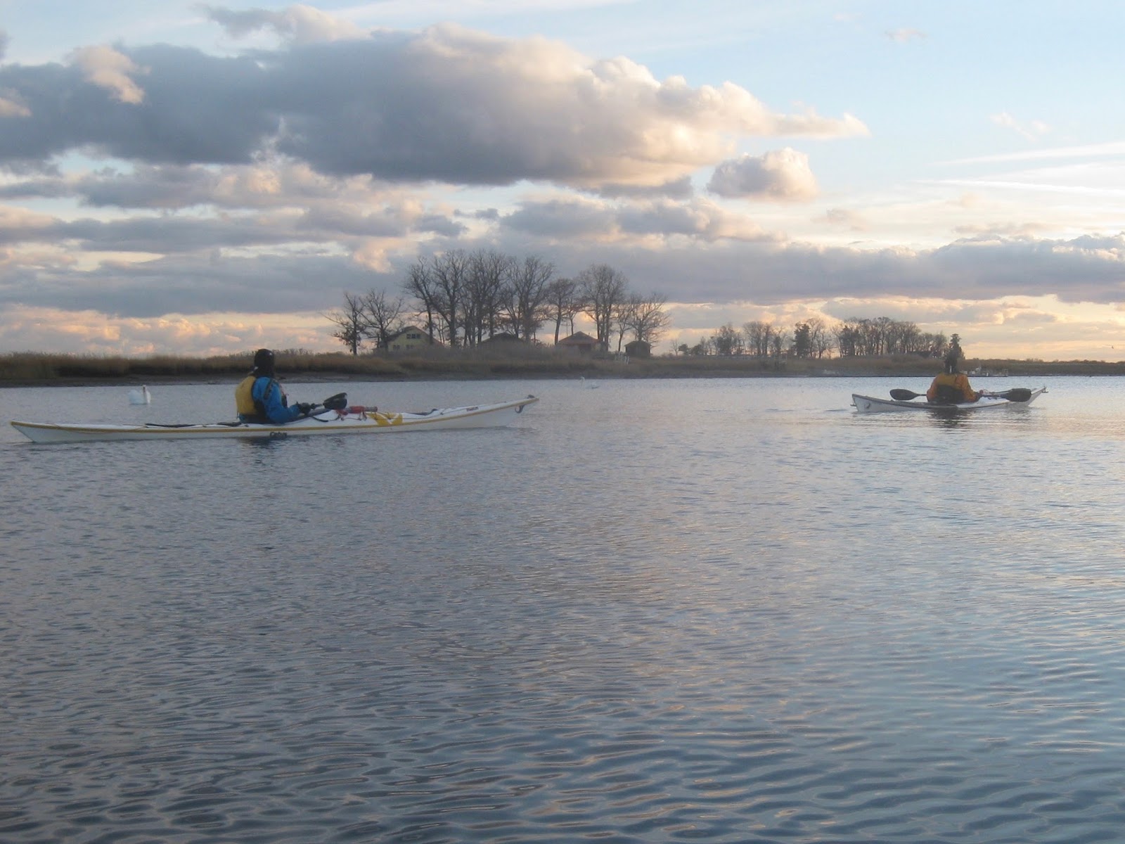
Paddling again past Hen Island.

Contrails, Clouds, and Sunsets.

Approaching the harbor, we had to wonder if all those contrails in the sky were holiday traffic taking visitors home.


As we approached the harbor, we could make out a lone figure in Mango yellow with a white hat, walking about on shore to keep warm. Jean radioed in to let Alex know we would be there soon, and with sunlight dwindling, he prepped his boat so as to get going right as we approached. They had to paddle another couple of miles back to their boathouse.

JT and I helped each other with our boats and drove off separately. By now it was dark; I'd left my house around seven in the morning, and hadn't considered how long the day might be. But it was grand - a journey of at least 16 nautical miles, a mildly challenging wind, a split group, and some great scenery, most of which was still new to me. It was a great trip, and one I'd happily do again.

Sunday, March 27, 2016

S.I. Saw the Light(houses)

Last weekend I made it out to the lower harbor again, joined by my good friend MM and some mates she invited along from her New Jersy club. All were experienced sea paddlers. Weather was very gentle, with low winds and only partly cloudy. It was a bit chilly, but warmed quickly.

Our goal was to paddle to at least one lighthouse, and possibly a second one. West Bank Light sits about four miles off Staten Island, two miles south of Swinburne Island, which is where I went to see seals earlier this month. Another two miles further is Romer Shoal Light, which is actually closer to Sandy Hook than to Staten Island. Both mark very shallow waters, warning big ships to stay away and serving as markers for smaller vessels.

As it happens, one of our party has a son who knows the owner of Romer Shoal Light, and through such short degrees of separation we were able to get permission to land there. You know, just in case.

In short order, we rendezvoused at the north end of Roosevelt Boardwalk, portaged and kitted our boats, and set out for our destinations.

Setting out past Hoffman Island.

The Verrazano behind us, Manhattan in the distance.

The water was a bit chilly when we left, but as we paddled we got warmer, and the water seemed nothing against our skin.

We pulled past Swinburne, watched a couple of container ships drive through the Ambrose Channel, and took stock of the lower harbor.

We were definitely on open water.

West Bank Light.

The lower harbor is one of the few places in NYC where a New York paddler gets a sense of the open ocean. The rivers around Manhattan are a tidal estuary, to be sure, but there are plenty of landmarks and the shore is never more than half a mile away. Even in the upper harbor, trafficked as it is, there's still a sense of being in relatively sheltered water. It's just a large bowl, bounded by Brooklyn, New Jersey, and Staten Island.

The lower harbor is still sheltered but immensely broad. The exit to the sea is between Sandy Hook and Breezy Point in the Rockaways - five miles as the crow flies.

Beyond that is the open sea.

Closer to the Light(house).

Far Out.

Looking up.

We marveled at West Bank Light. Unmanned, it's still an impressive presence. There is something appealing about lighthouses, in their remoteness and resilience, something that inspires admiration in all mariners.

This part of the journey had only taken an hour, and we were all feeling nice and warmed up. The flat conditions - Sea State 1, technically but barely - invited us to journey on.

Onward to Romer Shoal.

Take a Break.

Make Adjustments.

Romer Shoal Light has a curious history. Originally the lighthouse was ashore and used for testing new methods of lighting. One of its keepers disappeared at sea when he set out for shore, leaving his assistant in charge until his body was found. At various points the light was operated by the US Navy, the Coast Guard, and eventually automated.

Now it's owned by a Staten Island businessman.

Romer Light, Worse for Wear.

At this point we'd been paddling for about an hour and a half and had at least two hours paddling to get back, not to mention breaking for lunch. One of our number floated the idea of landing, and I took that as a nudge to work on my "manage a group landing on rocks skills", notably, have the person in a plastic boat land first.

That would be me.

I scoped out various places to land. The tide surged about one to two feet in a cycle, not breaking in our protected cove, but adding some vertical challenge. It was also near low tide so we had slimy, slippery rocks, and none that really offered a flat surface.

I found a spot, popped my skirt, then pulled myself out quickly before grabbing my boat and, with a little finesse, lifting it up on the rocks.

I then helped MM, and brought her boat up, and with two ashore we were able to help the rest out quickly.


Shore Landing. Not shipwrecked!

Shore Party - for Lunch!

We took our lunch and watched a dredging tug come in from sea. We'd spotted hear earlier, a vessel with four distinctive stacks on the corners, to make her a platform in shallow-enough water. Done with her work, she was heading in. From our vantage, we could take in the sea, Coney Island, Staten Island, and Sandy Hook with equal east.

Interlopers on the way back.

We launched in reverse order of exit and paddled back towards Staten Island. The tide was slack and therefore not in our favor as had been the case on the way out, so the trip took a little longer.

On the way back we saw a different sort of voyageur.

Another way to view the seas.

I should mention too that we saw seals, but not as many as before because we were not near their winter home. They showed up late - L and R missed them, but MM and I spotted them and lagged behind trying to spot more - so long in fact that eventually L and R stopped and waited for us, took pictures of us, and only later noticed the seal in frame! The photos have been posted on the New York Kayak Company Facebook page.

Unpacking.

Once back, we un-kitted and put our boats back on cars, then drove to a German bierhaus and had smoked meats, potatoes, and beer. It was grand.

Always a lovely day at sea to make new friends and enjoy new views. I hope to make it out here more frequently once the weather is warm.

Sunday, May 18, 2014

A Bridge Too Far

I had an idea to go north. I am trying to get myself into the habit of open-ended trips, loading up my boat to support all contingencies and adapting my plan to suit conditions. That said, I wanted a long paddle, to see just how far I could go. I figured I would head for the Tappan Zee Bridge, and stop short if I needed.

The original float plan was a little aggressive. High tide at Battery was 1300 on the dot, which meant I couldn't really get going before 1100 without fighting more than a little current. It also meant that I'd be arriving back at sundown, or later.

High Tide 1300
Low Tide 1900
Wind predicted to be 9 mph from the east.
1100 Depart
1200 Yonkers Water Treatment Plant
1300 Private Buoy
1400 Tappan Zee Bridge
Layover
1530 Return
1700 Piermont Pier
1800 Private Buoy
1900 Spuyten Duyvil
1930+ Inwood

I was looking forward to this trip all week, and packed and ready early, so I was on the water by 1025. A friend of mine had left earlier on a shorter trip north and I hoped to catch up with him, eddy-paddling as much as I could up the eastern side of the Hudson River. I never saw him - turns out, he crossed and went back down on the other side.

I made good time, hitting my first two waypoints at the same relative time (+1 hour, +2 hours) as my original plan. The day was beautiful, near-clear blue skies, a warm sun, and playful breeze. I passed some barges parked above Englewood Marina. There was hardly any other traffic on the way up.

In short order I was in Yonkers, then Dobbs Ferry, and then territory unknown to me. Most of the trips I've made up this far have been on the western side of the river. Here, I learned a lot of little township names, marking my way by train stations where I could see them: Greystone, Ardsley-on-Hudson, and so on.

I practiced landmark navigation, comparing what I saw with my chart. I found this to be really useful. I could see where I was by identifying landmarks on the chart. I could figure my aggregate speed by finding another landmark about a mile away and timing how long it took to paddle it, and also estimate how long it would take to get to a point by applying what I thought was my speed, +/- what I thought the tides were.

Onward I went, gradually realizing just how far I was headed. This was an open paddle, right? I wasn't dedicated to the Tappan Zee. I was just heading "north". But the bridge was right there. I was almost there.

Have I ever mentioned I am terrible at estimating distances? This was another thing I worked on. I could locate myself on the chart, and see how far I actually was from a landmark, telling myself, "that's how far a mile is".

Onwards I went. There are a a lot of neat little towns on the east side of the river - I don't know why my friends prefer the western side. But now I was opposite Piermont Marsh, a regular day trip for us, and soon north of Piermont Pier - into the "Tappan Zee", a sea, as the Dutch called it.


Passing under the bridge, I surveyed the various barges working to build the "new " Tappan Zee Bridge. I imagine that when it's finished it will be interesting to pass through, given a wider path over the river. As it turned out, President Obama made a speech with this bridge as a backdrop, a speech about infrastructure investment. No one asked why anyone ever though building a multi-lane highway bridge at the widest point in the river was a good idea. NYS lore has it that the governor at the time did it so that he had a key piece of infrastructure, just outside the jurisdiction of the multistate Port Authority, through which he could hand out patronage jobs.

Anyway.

Now I could see Tarrytown Light - just another mile or so. I could write about it, but someone else has done a better job. Around the corner was a beach, where I landed for lunch.


While there, I rested, and several passersby came along from a nearby park. A man with a camera walked past. Two fisherman went by; I would see them later having climbed out on the rocks of the lighthouse, catching a small fish after much effort. Some children came by and dipped their toes in the water, daring each other to drink it. None of them did.

The most interesting visitor was a Russian man, a big middle-aged bear of a man, who sat on a stump contemplating the water. He took off his shoes. He took off his socks. He took off his shirt, and then his pants! Now comfortably clad in only his skivvies, he waded into the water. He sat, soaking in the 44 degree water quite a while, before emerging and donning his clothes again.


I had marked the tide when I came in, and eventually noted its slow decline. Time to leave. I packed everything up, and set on my way.  Heading out was pretty straightforward, but below the Tappan Zee I ran into a steady headwind. It would keep up for nearly two hours straight.

I rarely curse the weather. Sometimes I beseech it, like asking the water to talk to the wind and tell him to stop being a jerk. In my cosmology, they are siblings, sister and brother. But this wind would not stop. I muttered under my breath. I argued with the wind. The wind would stop when I stopped paddling and pick up again when I did. Finally, I yelled at the wind before hunkering down and jus slogging through, muddling along until the current picked up and I got some nice little waves to play in on the way home.

I got back at 2000 or so - just a little later than planned, and not bad considering that after my head start, I fought headwind for two hours on the return. MH was waiting for me. He paddles evenings and had already come and gone, but stayed bc he noticed I was out "north" a bit early and hadn't come back yet.

I was tired, but not exhausted, not hypothermic or hypoglycemic or any of that So we caught up, and I washed up. We saw two kayaks go by and only learned later who they were. My inspiration, on a trip I aspire to!

All in all it was a good trip. I took a chance, paddling along so far so early in the year, but the worst I expected, and encountered, was wind, and even that was more annoying that terrible. It was a bonnie day, and I proved to myself how far I could go. I do need to improve my long-term paddling posture, but I ate well and planned well. Which, life doesn't always cooperate this handily but it's nice when it does.


Monday, August 12, 2013

Croton Camping Paddle

On the last weekend of July, I took off the following Monday in order to do some kayak camping with my friend MH. We've been meaning to do this for a while. We departed Inwood late Sunday morning and arrived at Croton Point in the evening; camped and hung out, then returned early Monday afternoon, arriving at Inwood as the sun set. It was a great trip.


We crossed the river to the west side and paddled up along the Palisades. We were a little concerned about the weather; there were even odds of rain, and radar showed a major weather front moving east from Ohio. However, as the day went on it also appear to be moving north, so we took our chances and simply enjoyed a cool day in place of the 90+ heat wave that had enveloped the city earlier in the week.


One of my goals for years has been to paddle to the Tappan Zee Bridge, just because it is such a recognizable waypoint. Here we approach the Tappan Zee; along the way we passed a friendly sailor who told us that Irvington, which we had passed already, was friendly to paddlers.

It was hard not to think of a sad story in the news the night before, wherein a bride and another in the wedding party were killed in a nighttime collision between a motorboat and a barge.


As we made our way up the river, we enjoyed generally benign conditions. There was hardly any traffic out, and wind was minimal. We had timed our trip to catch a fair amount of current, so even the paddling wasn't hard - all 5+ hours of it.


We stopped for lunch just above a lighthouse, landing on a small sandy shore. We had to move our boats a couple of times - we were there for less than an hour but the incoming tide threatened to float our boats away.


Lunch was just north of Tarrytown  Light - a retired lighthouse just north of the Tappan Zee. Our lunch spot was just around the bend below the wall in the photo above.


Eventually, we landed at Croton Point Park. We had paddled around trying to figure out the "Hudson River Water Trail" camping site, but as near as we could figure, that "campsite" was just sanctioned guerrilla camping. We found a spot, landed, and set up camp as the rain started to fall.


Here we have Camp MH (above) and Camp Cowgirl (below). The safety sawhorses turned out to be from some planned tree cutting we learned about the next day.


Since I set up my camp in the rain, I used my main towel to dry out my sleeping quarters. The next day I draped it over my boat.


I made the road my kitchen. I figured in the worst case, I wouldn't be able to burn the road down.


When we got ready to leave, I took time to repack my boat. I had a little less food and wanted to see if I could do a better job repacking. I did a little better but not a big difference.


When we were at Croton, I took some shots of the river. Above looking across Croton Bay.


Here, looking south from the southernmost part of Croton Point. The landscapes in this part of the Hudson River Valley are the same as the art style that it gives its name to. It is a dreamy horizon of sky, rocks, and river.

I didn't take as many photos - well, as many good photos - on the way back. We left early and crossed to the western side of the river, paddling down along parkland quite a ways. MH was scouting for possible future guerrilla campsites - though when we asked someone who was official-looking, he did say camping was prohibited.

On the way back, we paddled through a large marina (or two, it was hard to tell) in Nyack. I took a shot at rolling my camping-laden boat. I succeeded, if you count as success "I came halfway up and then high-braced before I rolled back in." I also noticed I had to adjust my sense of where to place the blade in part, as far as I could tell, because the drybag on my rear deck was pushing the boat up a when capsized.

We stopped at Piermont Pier on the way back for lunch - this is a long pier that extends out from Piermont, nearly halfway across the river and acting as a sort of marker to the lower end of the
"Tappan Zee." We rested, talked with another paddler, and then packed up for the final leg home.

There was quite a bit of wind from the west as we passed Piermont Marsh, and we charged past it to take windshade from the Palisades. The current went slack, and we picked up the pace. MH showed off his prowess, speeding ahead and waiting for me. We got home at dusk.

It took about six hours of paddling each way, plus an hour and a half rest, sometimes one stop, sometimes two. It was a pleasant paddle both ways, if a little windy on the way back. Total distance was about 46 miles, about 23 each way. I've paddled about 30-32 miles in a single day, but never such lengthy distances two days in a row.

It was good camping experience. I haven't camped in a long time, and never from a kayak. MH was a great mentor in this respect, and I hope to camp with him again some day.

A map of our route:


View Croton Camping 2013 Actual in a larger map