Saturday, October 22, 2016

Stars, Aligned

It started with a move of camp. During the Mid-coast Sea Kayaking Rendezvous, I'd been camping in a tent at the Sagadahoc Campground, but after that I moved to the AMC Beal Island camp at Knubble Bay. I pitched my tent and set up my kit, then met fellow candidates as they filtered in. Most had also been at the Rendezvous.

Reminder, once back home.

We were all here to take a two-day assessment for the British Canoeing Four Star Sea Leader award. In the BC scheme, the first three stars are personal paddling skills awards; after that, the fourth and fifth stars are leadership awards. Paddling skills are part of the assessment, but the baseline assumption is to take those skills and apply them in progressively more challenging conditions, and also to lead a group of paddlers in those conditions: planning trips, accounting for weather and currents, and being capable of rescues if something goes awry.

I think it's worth contextualizing the BC scheme in general, to contrast with some of the move skills-based assessments I've taken in the American Canoe Association (ACA) scheme, and my paddling experiences in New York City. In the sea kayaking discipline, there's an assumption of a journey, and along that journey the group might encounter various features to play in.

In my formative paddling experiences, so many of the attendant skills were imaginary. When would I encounter rocks or cliffs? Or ocean swell-based surfing? My journeys were about getting from point A to point B, and ever mind what was in between. The biggest obstacles would be commercial marine traffic.

Therefore, working towards the leadership award meant not only affirming specific skills, but also practicing a different leadership style, one that was open to group play, and less insistent on shepherding the group like a docent in a museum.

I didn't take many photos. On assessments I want to be as alert as possible, and also want to keep my deck clear of any unnecessary equipment. The last thing I want is to get caught out futzing with my gear when I should be paying attention to the group and the environment around me.

Day 1
It was quite possibly the quietest breakfast I've ever had in the camp cabin. This was my fourth time to Maine, and to the cabin; I'd previously paddled here for fun, and also taken my Four Star training the year previously. As other candidates shuffled in and made breakfast, each pored over NOAA tide tables and charts, locking in those vital details of the dynamic environment we'd be tested in. It was like monks at breakfast, each candidate locked in their own focus on the day coming ahead.

If it sounds intense, it kind of is. It's a two-day assessment. If one were to look at the syllabus, there are many broadly-stated skills checks, from things as simple to properly lifting and carrying boats, to rolling on both sides in seas up to a meter in height and in moving current, to rescues in conditions, to navigation in poor visibility and moving current.

It's not an inexpensive award either, between the cost of training (mandatory to register for an assessment) to the assessment itself. Failure hits the ego, and success, while gratifying, just means formalizing a level of responsibility. You can't say, "I'm qualified as a Four Star sea leader", and then go on a trip someone else organizes without paying attention to how you'd organize the trip, or by sitting back quietly when something goes awry.

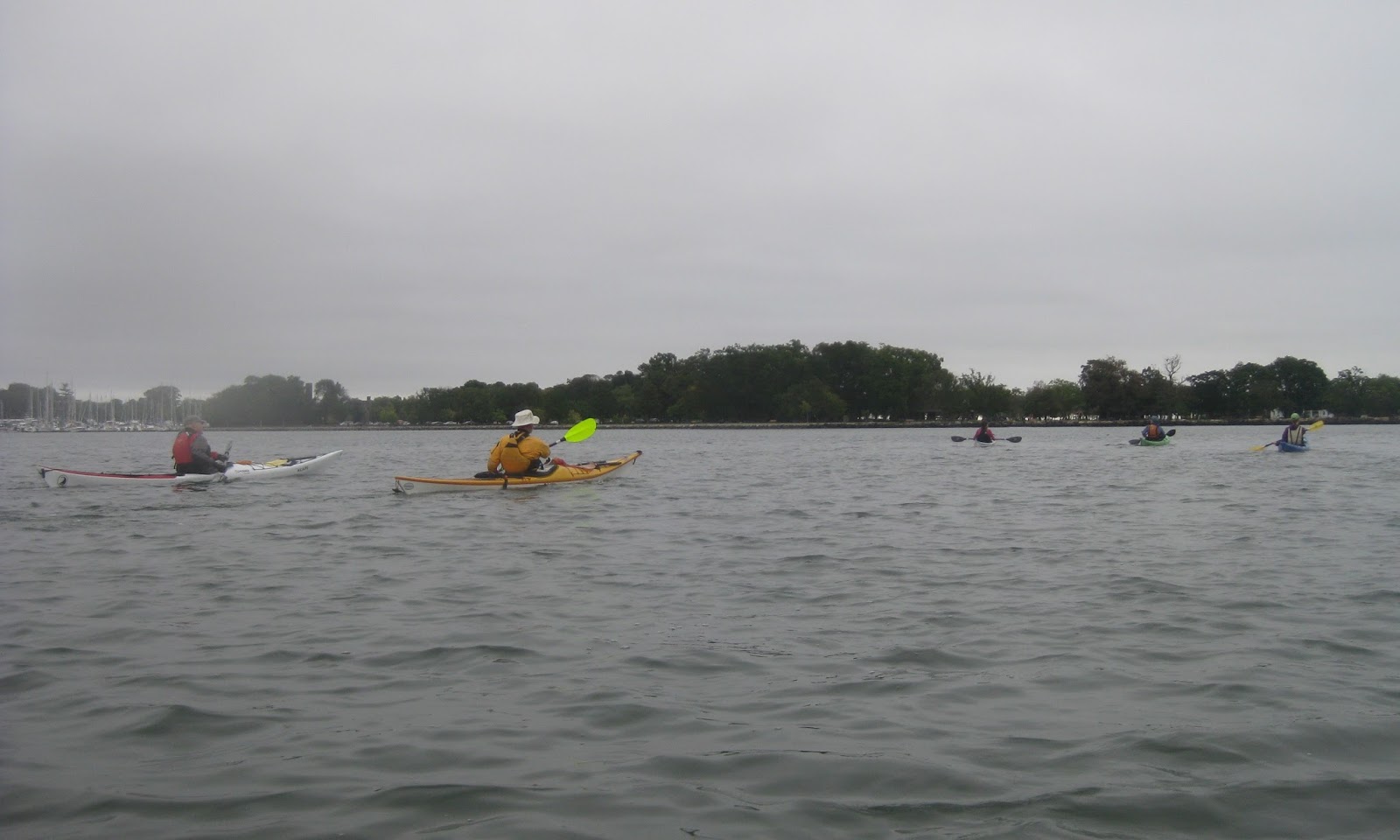
Due to the number of candidates, we were organized into two separate assessments with two assessors each, and an assistant or two in each. Our classes were subdivided in half, so on each day we'd work with one assessor and on the following day the other. In my pod there were two more candidates besides myself, and we took turns leading our group of three "teabags" (practice students) in conditions.

Our basic route for the day was to paddle from a beach launch at Reid State Park up to the Five Islands area; thence across the Sheepscot River and back, and from there up to the camp at Knubble Bay. We three candidates were tasked with sorting out the route and deciding who would go first, second, and third. GA took the first length, I took the crossing, and MS guided us back to camp.

While another candidate was leading, those of us "off" were permitted to play, and at various points asked to perform certain skills or answer certain questions. While GA was leading, MS and I took a large breaking wave sideways and backed out of it using some reverse strokes to gain momentum over the next wave. We also did rolls in three-foot waves just a few yards from a rocky cliff. Later, we also had to roll in moving but flat water.

On my leg of the journey, my central challenge was to get the group across the Sheepscot River to a specific point with a lighthouse. The river is about a mile wide, and the initial task was pretty simple for me based on my experience. The crux points were gathering the group together, making the crossing, and arriving, and on the return, the reverse, with an additional waypoint.

Aside: in the distance, we glimpsed porpoises.

I did nearly screw the pooch on the return though. I was tasked with not only getting the group back across, but navigating to a ledge in the middle of the river, and from there on a difference course to the northern tip of Turnip Island.

First, when asked directly for a bearing, I waffled on the declination. I also took my bearing off a charted buoy that I could see with my eyes; subsequent discussion with the assessor made it clear the expectation was to navigate to the ledge that was just north of the buoy. I gathered the group together and led us to the buoy, and from there changed course to Turnip Island. It is very easy, with the numerous islands in the area, to mistake one for another, or to mistake a headland for an island.

Second, as we crossed, the river had just started to ebb, and further upstream there was a long, shallow bay beginning to empty into the Sheepscot. This produced just enough tidal flow to push us south a bit. Now as we crossed, I simply eyeballed this and got us to the buoy and then to the island. In the debrief though, the assessor made very clear that the task was to navigate by paddling a heading and course that accounted not only for the declination but also the ebb. My heart just about sank. I seriously believed I might have failed right then and there.

In hindsight, I would have estimated an additional change in heading by estimating the flow of the river (rule of thirds) and figuring where we'd have drifted to, then eyeballed the difference between that and the course I'd plotted, and estimated an additional set of degrees to add.

Most of my guiding experience is in waters I know and in good visibility. It's easy to pilot based on landmarks, and adjust course visually by taking ranges. If the current is moving me faster or slower than expected, I can see that, and intuit course corrections.

That won't work in poor visibility whether at night or in fog. And, it was becoming foggy, as a warm front moved in, bringing moisture that curled and sat over the water. We still had a few miles of visibility when I came "off", but if we hadn't, finding that ledge, that marker, and that island, would have been far more challenging. This was a very real skill that I needed to demonstrate.

That night, I got super-remedial. With two other candidates eating in, we got around the table and reviewed our notes, and I zeroed in on declination, and made sure I wrote down at least four different data points each for local tide heights and time of current change.

I was not going to get caught out like that again.


Day 2

With the dawn of the second day, I awoke, still kicking myself about the previous day's mistake but resigned to it. I wasn't going to fix the past; I could only take care of the day ahead of me. I made breakfast, checked my notes, and transcribed them to my deck slates.

Tides and currents on the left, with peak currents noted.

Trip log and waypoints, for dead reckoning.

The second day, we launched and landed at the camp, making a round trip around Macmahon Island to the Five Islands area. Once again, GA started, then MS was second, and I only lead the group for a short bit for feature play and landing at Five Islands, and later for the final push past Robin Hood cove to the camp.

The day was nicer, and quite a bit warmer. In fact it got hot in our drysuits, something of a predicament given the cold water that made them necessary. 

The first half of the day was relatively straightforward. GA led us out to the river and south a bit. I spent a lot of time taking bearings and comparing them to the compass; I was told later that this was noticed by the assessor and I expect worked in my favor. Even if I wasn't being asked, I was ready to answer where we were and what was going on.

When we landed at Five Islands, we landed in a slightly different location after being informed the group ahead of us had had "a real incident". In the course of the assessment, a candidate in another group had been sent to find features for the group to play in; in the course of doing so, she ended up in a bad position and her boat was damaged. 

Once ashore, of course the plethora of candidates all had boat repair kits that they wanted to whip out; if anything the challenge the assessors had was to keep the event from turning into a marathon repair session. In short order, the boat was patched enough to be seaworthy, and the candidate was able to finish the assessment and paddle back to camp. The good news is that she rolled more than once to stay upright, so you could say her roll was stronger than her boat.

After lunch, as our group moved up the Shepscot, we stopped to do some self-rescues. Each of us candidates, and our practice students who opted in, did both re-entry and roll and also scramble rescues in a spot of water with 3-4 foot breaking waves, less than ten feet from a bald-faced boulder. Afterwards, we did an "all-in" rescue. MS and I paired up and got my boat empty, then me in it, then finished our rescue, by which point our mates had done the same. It was great fun !

Shortly after that we did a tow rescue. We'd done some short tows before, as well as rescues the day before. Here, we had one person support the casualty, towed by another, with a second in-line tow. We went quite a ways, further, I think, than any practice tow scenario we'd had before. And here, we had some dissension by the lead candidate. 

Basically, he had lodged in his head that the little Sheepscot, the stream between Macmahon and Georgetown islands, had a tidal current that exceeded the remit. The "remit" is the limit of conditions in which a candidate can take a group, and part of the assessment was being able to recognize conditions that exceeded the remit. One of those conditions is tidal currents not to exceed two knots. Based on an anecdote about a standing wave, he thought the river would exceed the remit.

The thing is, it wouldn't. His key data point, in addition to the anecdote about a standing wave, was based on an overfall two miles north. A closer data point indicated slower speeds that, while high, were within remit. Furthermore, we were at a point in the tidal cycle just before slack. While even at peak we'd be in remit, we were certainly well below it. So, rather than taking his preferred route around Macmahon's eastern side, adding miles of towing for our simulated casualty, the assessor had us paddle up the lower Sheepscot quite a ways, and that was fine.

At the end of that passage, I took us in the final leg for the camp. I was fortunate in that the water had just started to ebb, and there was a group ahead of us demonstrating a good line to take. I still played it like they weren't there, directing my group via landmarks and making some jokes to keep everyone engaged, rather than quietly paddling along. We came around the "knubble" and into the camp's cove, and disembarked at the highest tide I've ever been in there. 

The landing beach was entirely covered, as well as the final step of the stairs leading up. All the groups had arrived at about the same time, so while it was crowded, with many hands we made light work of carrying our loaded boats up the stairs.


Debrief
At the start of the assessment, one of the assessors addressed our anxiety by saying that their role was to ensure we were fully prepared to be sea leaders, and that we would not have been there if we did not have the required skills. I really liked this statement. At this point in my paddling career I have taken several assessments and I've truly sweat them all, even while I was confident. The goal is to become a better paddler, not to accumulate awards. So, pass or fail, we were all going to get feedback on how we could improve.

As far as I could tell, I was the first of our group called in. I may have been wrong but it wasn't a long wait. I'd changed into street clothes and finished un-kitting my boat, and just started in on my camp. My feedback was as follows.

  • First, I passed. Both assessors agreed on this.
  • My group leadership was a little "guide-y", but that was attributed to my experience being predominantly in a working harbor. In a more open, less trafficked environment, group leading can be more like a rubber band, or a retractable leash.
  • We did talk to the navigation errors, and at this point it was made clear that they saw me put extra effort into it the second day. 
  • My action plan is to go lead some Four Star trips and really lock in that experience, and focus on my navigation skills, rather than go straight to Five Star. Which, I gotta say, is totally fine to me. The way I'd put it is I'm a bit "coached out" after working hard for this award, and five days of coaching and assessing. I could use a break of just paddling and guiding for fun!

I'll say that this is largely how I feel after any assessment; relief, and also, barely able to conceive starting down another. I felt this way after my 3 Star in particular, but also my instructor assessments. Oh my God, I think, that was a lot of effort and I made x, y, and z mistakes. But, a year or so later, I'm fully recovered, and ready to start in on the next.

We'll see how I feel. For now, truly, I just want to paddle.

Denouement
With that, I finished packing up the tent and all my camping gear. My paddling clothes were soaked with days of sweat, and my drysuit was stiff with layers of sea salt. 

I lingered for a little bit to see how some of my fellow candidates, including some who were in my group in the Rendezvous but not the assessment. Nearly everyone I asked passed; I only found one who had not. Everyone had different feedback and action plans, from setting up safe play areas to navigation to personal paddling skills. There is always room for improvement.

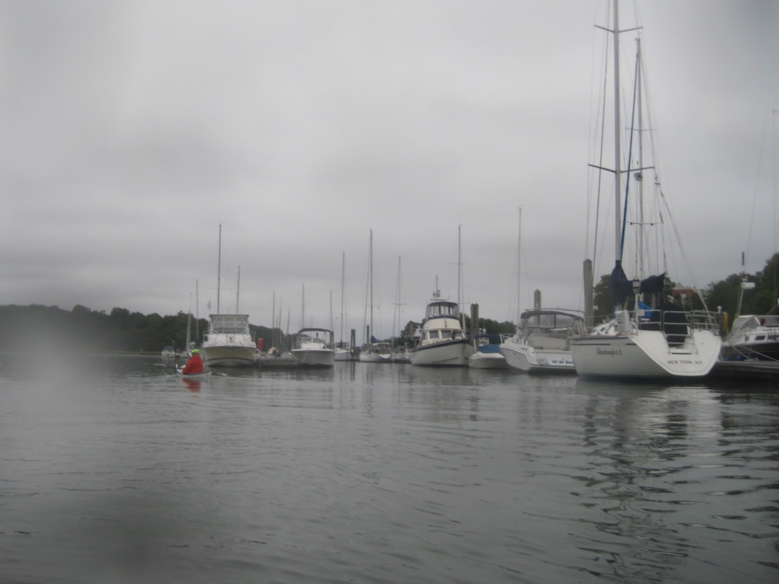
With some help, I loaded my boat on the Saab and got going, driving down the rutted road, to the steep gravelly climb, to the town road, to the county road, to US 1, to the interstate. I stopped at the last service center in Maine to take this photo: a woman, her Saab, and her boat:


I've been paddling ten or twelve years now (truly, I am not certain). I've been more serious in the past four. Certainly the past year, starting with that Four Star training I took with John Carmody, Todd Wright, and Steve Maynard, kicked off a pretty intense period of not just practicing, but logging my trips and making sure I got experience leading groups in conditions more advanced than "Force 2, Sea State 2, partly cloudy on the Hudson River". 

This award meant a lot to me, an in particular, it's a responsibility, not an achievement. I need to practice more, for sure. I got my own car this time last year, and since then I've expanded my range, literally and figuratively. I really do look forward to more paddling, and paddling more, if you know what I mean.

Like the song goes, "the road goes on forever, the party never ends."

Rendezvous 2016

I loaded everything up the night before with a friend who was attending. The "Mid Coast Sea Kayak Rendezvous" in Maine, hosted by Messrs John Carmody and Todd Wright, and others, nearly two dozen coaches in all, in the Georgetown/Sheepscot River vicinity of Maine.

I've been up there a couple of times before. The first time, on account of my friends at Wind Against Current, Johna Tilson and Vladimir Brezina. A second time, for my Four Star training, and again last summer to get some experience and a rematch against the boilers at Lower Hell Gate. The area is rife with traditional sea kayaking features: sea, rocks, surf, strong weather, surging seas. It's a brilliant area for honing skills, and the Rendezvous - a symposium - was going to be a great way to work on all my dance moves.

I have to say, being a child of the "hooked on phonics" generation, I always sound it out as "Ren-Dez-vous".

I was getting over a bad cold from the weekend before, throwing extra bottles of water and an extra face-rag in the passenger seat of my Saab. I had the Gemini SP loaded up on the rack, strapped down and tied off on the front and back. It's about a 6 hour drive from New York City to Maine, interstates to highways to county roads to smaller paves roads, to rough drives and eventually, rutted grooves in dirty lined with gravel and tree roots, to my campsite at Sagadahoc Bay. Here, I'd pitch a tent on the opposite side of the bay from the main event, a bay that became a mud flat at low tide, on a weekend with a Full Moon and the correspondingly high tides.

Organization
The event was three days of paddling with various coaches: Saturday, Sunday, Monday. Eveyone who arrived was given a color bandana indicating which group they were assigned to: teal, green, pink, dark blue, and so on. My group was dark blue. The idea was, we'd come together in these groups of half a dozen or so paddlers, and each day we'd have two marquee coaches and possibly an assistant coach, and we also have a local coach or expert who would stick with us for all three days. So, our all-weekend guy was a Rhode Island paddler named Tim, and we had different experts with us the other days.

The weather, by the way, was brilliant, sunny and not terrible winds the whole time. My only complaint was Friday night, which dropped below freezing. I'd brought extra layers and still woke up cold in the middle of the night. Fortunately, remaining nights were progressively warmer.

Day 1
Day 1 were paired up with Ron G and Christopher Lockyear of Committed2theCore & Bay of Fundy Sea Kayak Symposium. About 2/3 of our group were candidates for a leadership award, so we were given ample opportunity to practice leadership skills. The first was launching off a rather dumpy beach in Reid State Park, and I have to say the paddler tasked with that seemed a little oblivious to the nicer stretch of surf about a hundred feet further down from where we'd set our boats. He got two out but after three unsuccessful attempts to launch yours truly into some four foot walls of incoming water, I organized a coup and the rest of us launched in the less dumpy part of the beach.

This must be the right place.

Once underway, we set out on a little journey, south from Todds Point to, eventually, an island called Pond Island. It's a small rock of an island, with a lighthouse on top, and sort of the middling point between the very end of Sagadahoc Bay and the Kennebec river. We played over rocks and some surf, and after lunch on the island, enjoyed a nice tiderace that formed to its north on the ebb.

Landing at Pond Island.

The lighthouse at Pond Island.

A lookabout.

Solar power for the win.

Like ants, crawled from the sea.

A gorge. Hard to make out in this photo.

The tiderace was great. It was amazing, and I've never been in anything like it. Sure, I've been in current, and bouncy water, but never anything so big and moving and consistent as this. It was tremendous - and it wore me out. I kept thinking we'd move on but we didn't, and towards the end I had to drop back in the eddy to rest and get some water. I was still not even 90% on account of my cold.

Eventually, we did make it back to Reid, and sure enough the beach was less dumpy. I even pointed out why. At a lower tide, we could see how the beach ramped up rather sharply when the water level was up, but as we landed, as charted, it was flat quite a ways out.

That night, we had a pizza party, and I met up with BB of Canada, JC of NH, and met some new folks. A lot of paddlers at the Rendezvous were from Canada and Rhode Island - places I want to do more paddling in.

Day 2
On the second day our pod was paired up with two very experienced coaches, Sylvain Bedard and Nigel Foster.

Nigel Foster. For those who don't know the name (or who get him confused with Nigel Dennis), he's one of the O.G.s of the sport. He was paddling and teaching paddling literally before I was born, and has made a number of expeditions, including a circumnavigation of Iceland and 675+ miles from Baffin Island to Labrador. You can read more about him on Wikipedia, or his various websites (just look up "Nigel Foster Kayak").

His presence was a surprise to other coaches, who'd only been given notice that a pseudonym was attending as a last-minute "motivational speaker". This was like going to a local music festival and finding out that Keith Richards was playing. And then, you get to go on stage to play with him.

Nigel and Sylvain led us on a very short journey that gave us ample opportunity to play with a variety of features. The unifying theme was using the environment to maneuver the boats, in particular choosing to come in on the back of a wave or on top of one, and using current to turn our boats.

After launching off a different beach in Reid State Park (at Griffiths Head), we paddled a short distance out to a large rock island. I should mention that along the way, we saw a recurring breaking wave in the middle of the water, and I paddled out to investigate, seeing that it was a very shallow rock ledge, right before the water level dropped on the trough of an incoming wave, and shortly I was bracing and surfing in on the power of the ocean. Oh my God, it was awesome.

At the island, we found a little cranny where water would surge through, after having lost much of its force hitting the island. If we paddled through on the front of an incoming wave, we'd have less steering control, and not very much depth to go over the rocks in the channel. If we waited and came in on top or on the back of a wave, we had more depth. So that was the game: timing.

To the island !

Setting up overwatch.

Lining up.

Paddling through.

Shortly after that, we worked our way up a bit of coast and landed on a rock beach below a picnic area, and after lunch went 'round the corner to where a pond was dropping a very forceful amount of water into the sea. This whitewater feature gave us very, very strong eddy lines to play against, and we practiced ferrying across, peelouts and eddy turns, and even just turning our boats in place on the eddy line. I'm happy to say it felt like cheating on that last using the Gemini SP; it was so short I could sit literally on top of the eddy line and had perfect control.


Moving right along.

Lunch !

Amongst our group was an amputee. Dave never shied away from helping to carry boats or move kit, and was a very capable paddler as well; he later passed his Four Star. He was great to paddle with.

Dave (left).

In the back, our Kenobi.

While we lunched, we also saw some features and islands emerge as the water level dropped.

A feature emerges.

The riverlet.


After that, we went out a ways and paddled in wind. It had picked up a bit, and against the current a bit gave us something fun to play in. We practiced maneuvering our boats on waves, and two more things new to me: changing our hand placement for "gearing" our strokes, wider for stronger and powerful and more narrow for a touring stroke, and dropping a blade in the water to act as a sort of skeg, or a slow-motion pry, to help turn in wind.

Sylvain and I had paddled to the forward edge of the group, and while watching each other work, we caught sight of a visitor: a seal who poked his head out to spy on these strange creatures bobbing on the waves. He ducked before I could grab my camera.

That night, we had a slightly more formal dinner, with excellent lasagna and salad. Two students from SUNY Plattsburgh's Expeditionary Studies program presented on a journey that'd made, taking a month to circumnavigate the Scottish highlands, a journey of about 540 miles. You can see video from their expedition at Zander's YouTube channel.

Day 3
On the third day we were paired up with Josh Hall, of South Carolina. He's an Instructor Trainer in the ACA scheme (possibly, I may have misheard, an IT Educator). By the third day everyone was feeling a little tuckered, and with long drives home for many, it was a short day, with a one-way paddle from the Five Islands area up to the Knubble Bay area, then back.

This was a fairly relaxed journey, with time to play in various features. By this point I'd built some confidence in paddling up and over diagonally-set rocks, going in on the peak and paddling out as the water receded. Though, at one point, I'm pretty sure I left some red plastic on a rock !

A sunny day.

Setting a fit of the spraydeck. 

We paddled up the eastern side of Macmahon Island and entered Goosneck Passage as the water ebbed. This gave us a bit of current to play in and practice ferrying against, and we attained our way to a small rocky island in the middle for lunch.

Landing at Gooseneck Island.

We headed down the western side of Macmahon. One curious feature we noticed was that, while the water was ebbing, we were going against the current as we headed south - but then part of the way through, we had current with us. As near as I could figure, the passage was like two bowls next to each other, with the northern half ebbing north into Gooseneck, and the southern half ebbing south into the Sheepscot.

Shore along Robin Hood.

Close to a house.

Around the passage.

With the completion of this voyage, the Rendezvous came to an end. I made several new friends and saw a few old ones, and met some amazing coaches and picked up some top tips from them. More than anything else I got practice in an environment and features that I rarely get to, and that was tremendous.

While New York City has strong tidal currents and a certain cachet amongst paddlers, it's short on traditional sea kayaking features such as surf and rocks. After all, it is a natural harbor. So I go further afield to get those experiences.

The Rendezvous was a great experience and I highly recommend it as a go-to event. I hope to attend next year - but regardless I expect this won't be the last time I paddle in this part of Maine !

Monday, October 3, 2016

Return to Execution Rocks

I recently had some friends together for a trip out to Execution Rocks. You may recall a similar trip with some of the same people last spring; this was a chance to bring some new people out, starting and ending at a different location as well.

Along with my friends the Two Geeks (Jean and Alex) and the current Mr. Cowgirl (Dave), I invited a client (R) and a member of the Inwood Canoe Club (G). Jean and Alex also brought along B, a woman I met at the Hudson River symposium last July, who also keeps her boat where the Two Geeks keep theirs.

I gotta say, it was might fine to have such a sizable group for some proper sea kayaking on Long Island Sound !

The day was overcast with a chance of rain; it was a bit drizzly in the morning but afterwards, just cloudy. There was a wee bit of offshore wind on the outbound leg of our trip, giving us some decent-sized waves to slide over.

Leaving Orchard Beach Parking Lot.

Passing the "Floating Man-Caves".

Alex and Dave: Geek Buds.

Allons-y !

Columbia Island.

I meant to spend more time around the various little islands on the way out, but with a group our size and the enthusiasm they brought, we breezed by High Island, Columbia Island, Pea Island, Huckleberry Island, Davids Island. Of them all, Columbia has the most obvious visual interest: a former CBS broadcasting station turned in to a private home by filmmaker/etc Al Sutton.

We were more taken with Execution Rocks - a storied lighthouse marking reefs in the middle of Long Island Sound, supposedly named for a time when the British would chain American rebels to the rocks at low tide and let nature take its course.

True? I really don't know. But, it makes for a good story.

Approaching Execution Rocks.

A Rival Tour Group.

Taking a Break.

"Thataway !"
As it happened, the weblog Atlas Obscura had arranged a tour of the island, which arrived about the same time we did. We watched as a charter ferry maneuvered to the island, dropped off passengers, and then found a mooring, after which it dropped some sit-on-top kayaks into the water for smaller vessels to take back to the island.

Waiting for Traffic.

Execution Rocks.

Far Side.

B had to return home, so with the blessing of the trip leaders, she paddled on her own back to New Rochelle, and texted later that she arrived home safely.

Rounding the eastern end.

Pose !

More.

More. More !

Our curiosity sated, we paddled onwards to Sands Point, Long Island, passing along the "Gold Coast" of posh estates once established by titans of the Gilded Age (your Goulds, Guggenheims, Rockefellers, etc).
The Gold Coast.

"Gatsbyland".

Cormorants !

Long Island Sound.

Our destination was a small slice of beach where we could safely stash our kayaks and climb up to a park that was a former Jay Gould estate. There was some sort of community festival taking place, and as we traipsed the grounds in our colorful paddling clothes, we got lots of curious looks a smiles from kids, mums, and dads.

We took lunch in a vending area located in the old carriage house.

On the way up, I glimpsed swans paddling along the shore of the bay.

Swans at Sea !

Gould Estate.

Tourists !

The House.

The View.

The Grounds.

The Apiary.

On the way back, we had current pushing us east - an inconvenient direction. We also spotted a barge in the distance chugging against current, and after some dithering opted to power forward and pass the barge. We made it with room to spare, but at maximum effort, we took a breather at the rocks again. The tour group had departed.

Color, Black, and White.

From there, we decided to extend the tour by paddling over to Huckleberry Island. By that point, some in the group were growing tired, so we headed back in through more sheltered waters, through a marina north of where we'd put in.

Behind Glen Island.

Marina.

Marina.

Marina.

WE seem to have crashed a wedding or wedding reception.

Wedding,

Finally passing the place we'd exited in the first place.

Relaxing.

And on back to Orchard Beach.

The Return.
This was a great trip despite the overcast weather; in fact, after a long, hot summer many of us welcomed the protection from the sun. The water is still relatively warm, so despite the looks, it's not quite winter paddling.

Paddling the Pelham Islands, and to Execution Rocks, is a great sea kayaking trip, one I hope to do again. And, it was great to see the Two Geeks! Be sure to check out their blog.